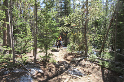
 The Spring Creek Park area provides access to several trails and a spectacular look out with views of 5 lakes and 3 mountain ranges. It can be accessed either from the road (which may or may not be passable to horse trailers) or from the Lowline Trail out of Little Soda Lake. We have done both. We parked on the road that branches off from the Willow Lake Road. That requires riding several miles on a wide open dirt/gravel road. All of the following photos were taken on October 7 and 9.
 Spring Creek Park and Trapper Lake trails go out from this area. Check out the post on "Willow Lake" for more options in this area.
(Click on any photo for enlarged images. Some photos courtesy of Teisha Preece.)
 |
| These are directions from Pinedale to FS Road 753. Google shows it can be traversed by car. This doesn't take into account the bad road conditions including ruts and wash outs. |
 |
This is the track, parking just inside the road turn off (Forest Service Road 753) from the Willow Lake Road (FS 752). Again, the track is over 13 miles Guide recommended to reach the overlook trail. |
 |
| Lake at Spring Creek Park |
 |
| Forest Service Road 753. Cars and other vehicles allowed. |
 |
| Off road trail right in Spring Creek Park. |
 |
| Off road trail right in Spring Creek Park. |
 |
| Off road trail right in Spring Creek Park. |
 |
| Forest Service Road 753. Cars and other vehicles allowed. |
 |
| Meadow and cattle man's cabin right in Spring Creek Park. |
 |
| Forest Service Road 753. Cars and other vehicles allowed. |
 |
| Forest Service Road 753. Cars and other vehicles allowed. Although, there are some "iffy" spots. |
 |
| Forest Service Road 753. Cars and other vehicles allowed. |
 |
| Forest Service Road 753. Cars and other vehicles allowed. This was taken October 7, 2017 as were many of the other photos. |
 |
| Meadow at the beginning of Trappers Lake Trail. (The one that says "Parking Lot" on Google Maps.) |
 |
| Overlook trail continues as a doubletrack. |
 |
| Overlook trail continues as a doubletrack. |
 |
| Trail to Trappers Lake. No signs. |
 |
| Trail to Trappers Lake |
 |
| Trail to Trappers Lake |
 |
| Trail to Trappers Lake. Obviously the Wilderness boundary. |
 |
| Trail to Trappers Lake |
 |
| Upper Overlook trail. |
 |
| View of the Wind Rivers from the Overlook. |
 |
| Looking at Fremont Lake from the Overlook. |
 |
| Spring Creek Park on the left, Soda Lake in the center and "No name" pond on the right. |
 |
| Willow Lake from the Overlook. |
 |
| Tosi Peak in the Gros Ventre Range viewed from the Overlook. |


No comments:
Post a Comment