
This ride was mostly pleasant. A good option if you're in the Pinedale area and want some easy beach riding. Has aspen and evergreen forests, meadows, open sagebrush country and gorgeous vistas of the Wind Rivers and surrounding areas. This particular route has a lot of "open" riding, so...in the summer, cloud cover is appreciated. Can be accessed as early as April, but you will be riding in snow. Willow Lake is not part of the protected Wildlife Habitat, but Soda Lake is. Most of these photos were taken July 9, 2016. The first photos are of that ride from the "bottom beach". The second batch of photos is of the "top beach" ride taken on August 21, 2019. See the post on Spring Creek Park for more options.
(click on any photo to open enlarged images. Many photos courtesy of Teisha Preece.)
 |
| Directions from Pinedale, WY, About 8 miles of dirt/gravel road which is usually in decent shape. DO NOT take the alternate route suggested by google maps that goes from 40 Rod Road. It is NOT even passable. (We talked to some out of state folks who made the mistake of trying this and it added 3 hours, couldn't get through and had to drive back to Pinedale and re-route.) |
 |
| Total mileage ridden July 9, 2016: 10.28. Minimum altitude=7,664'; Maximum altitude=8,373'; Ascent/descent=1110'; Trail conditions: 65% dirt, 10% gravel/dirt road, 25% rocky. |
 |
| "Trailhead" parking. A good spot, but it involves about a mile back on the dirt road you drove in on. |
 |
| Typical of about 20% of the ride...somewhat rocky. A barefoot horse in good condition could handle it. |
 |
| One way to avoid some of the rocky spots. |
 |
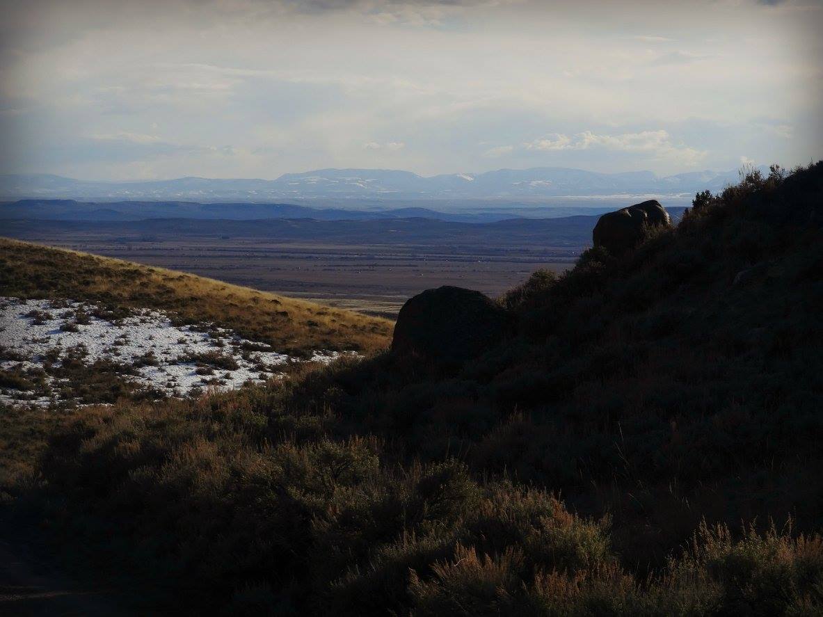
| View of Soda Lake |
 |
Beach riding right at the trail head.
|
 |
| April ride, photo courtesy Teisha Preece just coming up to the Spring Creek Park trailhead. |
 |
| April ride, photo courtesy Teisha Preece |
 |
| This is where we usually park. However, we saw numerous bumper pull rigs at the top parking lot. I guess it depends on the road condition. |
 |
| This was our route on August 21, 2019. Total mileage=about 12. Maximum altitude=8,307'. Ascent/Descent=1,520'. Trail conditions: 45% dusty road/sagebrush/some rocks; 25% soft dirt/grass/sand; 20% moderately rocky; 10% quite rocky. A barefoot horse in good condition can do it fine. |
 |
| We avoid most of the riding on the dusty road by riding in the sagebrush. |
 |
| After about 2.5 miles, we reach the "normal" trailhead. We were surprised to see bumper pulls parked here. How did they do it? |
 |
| Then, the terrain turns to trees. |
 |
| This is what most of the trail down the hillside looks like. There are a few dicey places on the switchbacks, but no photos of them. |
 |
| Lots of deadfall, but all passable. |
 |
| Nice forest, mosses, ferns, even wild raspberries, currants and thimbleberries. |
 |
| Nearing the lake, it opens up. |
 |
| I believe this is the trail to Snake Lake. |
 |
| Nice beach riding. |
 |
| Looking back up at the forested hillside that we came down. |
 |
| Close up of the track on the beach. |
 |
| Lots of downfall, but we got around it. |


No comments:
Post a Comment