We were looking for an easier route to Spring Creek Park and discovered these trails accessible from north Soda Lake. It's another way of accessing Spring Creek Park, Lowline--Soda and Willow Lake, but a delightful short ride all in itself. Park at the top of Soda Lake--Drive in from the east or the west. The east way has more potholes, but you get to see the "wild" draft horses. The west way has more washboard, but is slightly shorter. Please note human presence is only allowed May 1 through Nov. 30. https://wgfd.wyo.gov/Public-Access/WHMA/WHMA/Soda-Lake
(Click on any photo to open enlarged images.)
 |
| Route to parking pullout from Pinedale. |
 |
| Close up of parking. There is a picnic table and fire pit. So, as a camping spot, it may be in use during the summer season. If so, there are other options further east on the road. |
 |
| View from the parking pull out. |
 |
| Easy lake access from the parking pull out to give the horses a drink. |
 |
| One way to do the Habitat--Loop. About 6.5 miles. We did it counter-clock wise. Nice trail. Only about 3% rocky. |
 |
| Track showing the Habitat connector AND the Lowline going into Spring Creek Park. About 3.5 miles one way as compared to about 3 miles on the Forest Service Road and about 4 miles on the Lowline trail from Little Soda. Refer to those posts for more information. Trail conditions on this portion=60% soft dirt/grass; 30% dirt with some rocks; 10% moderately rocky. |
 |
| Along the Habitat Trail on Nat'l Forest land. As of October 2, 2019 there is a lot of fresh deadfall, but it is passable. |
 |
| Along the Habitat Trail on Nat'l Forest land. This is the passage through one fence coming back towards the Habitat. |
 |
| There are many of these signs within the Habitat along the trails and roads. |
 |
| Looking west towards one of the Habitat ponds. |
 |
| Road going north to connect with the trail. |
 |
| Almost to the trail. |
 |
The roadway looking west just before the gate out of the Habitat.
|
 |
| This is the correct gate to leave the Habitat and get on Forest Service land. |
 |
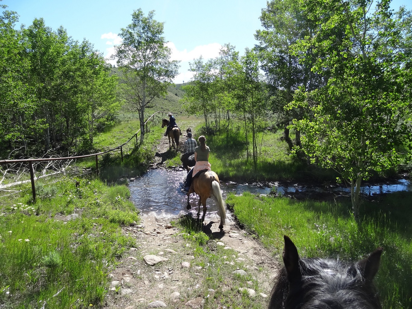
| Along the Habitat connector trail. Several little stream crossings. Lots of aspen. |
 |
| Along the Habitat connector trail. |
 |
| Along the Habitat connector trail. |
 |
| Taking the Southeast part of the "Loop" heading towards the Lowline. |
 |
| Taking the Southeast part of the "Loop" heading towards the Lowline. |
 |
| Large meadow on the trail connecting the Habitat and Lowline trails. |
 |
| Taking the Southeast part of the "Loop" heading towards the Lowline. |
 |
| Showing where to take the "Loop" from Aspen Meadow on the Lowline Trail. Not marked and you really have to look for it. |
 |
| West side of the Habitat Ponds. Take a right turn as you come out of the gate back onto the Habitat. This is another "loop" that will connect you back at the parking area eventually. |
 |
| More along the West Habitat Loop. |
 |
| More along the West Habitat Loop. A nice stand of aspen great for a break. |
 |
| More along the West Habitat Loop. |
 |
| More along the West Habitat Loop, heading off the road east by the stand of aspen shown in the photo below. |
 |
| Looking back at Soda Lake from the hillside on the East side of the Habitat. |
 |
| East side of the Habitat, May 9, 2020 |
 |
| West side of the Habitat, May 9, 2020 |
 |
| Ducks on the ponds, May 9, 2020 |
 |
| Ponds at the southern end of the Habitat loop. |
 |
| Ponds at the southern end of the Habitat loop. |
 |
| Berm which we crossed over to the east to get back to parking area. The signs below are near this part. |

 |
| Yay, came right out in sight of the trailers! |
 |
| June 23, 2020 |
 |
| June 23, 2020 |
 |
| June 23, 2020 |
 |
| Heading back to Soda Lake parking....June 23, 2020 |