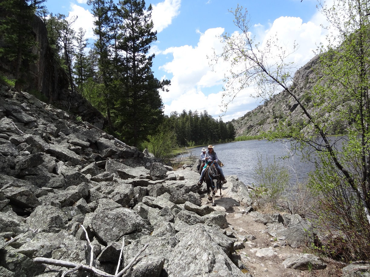
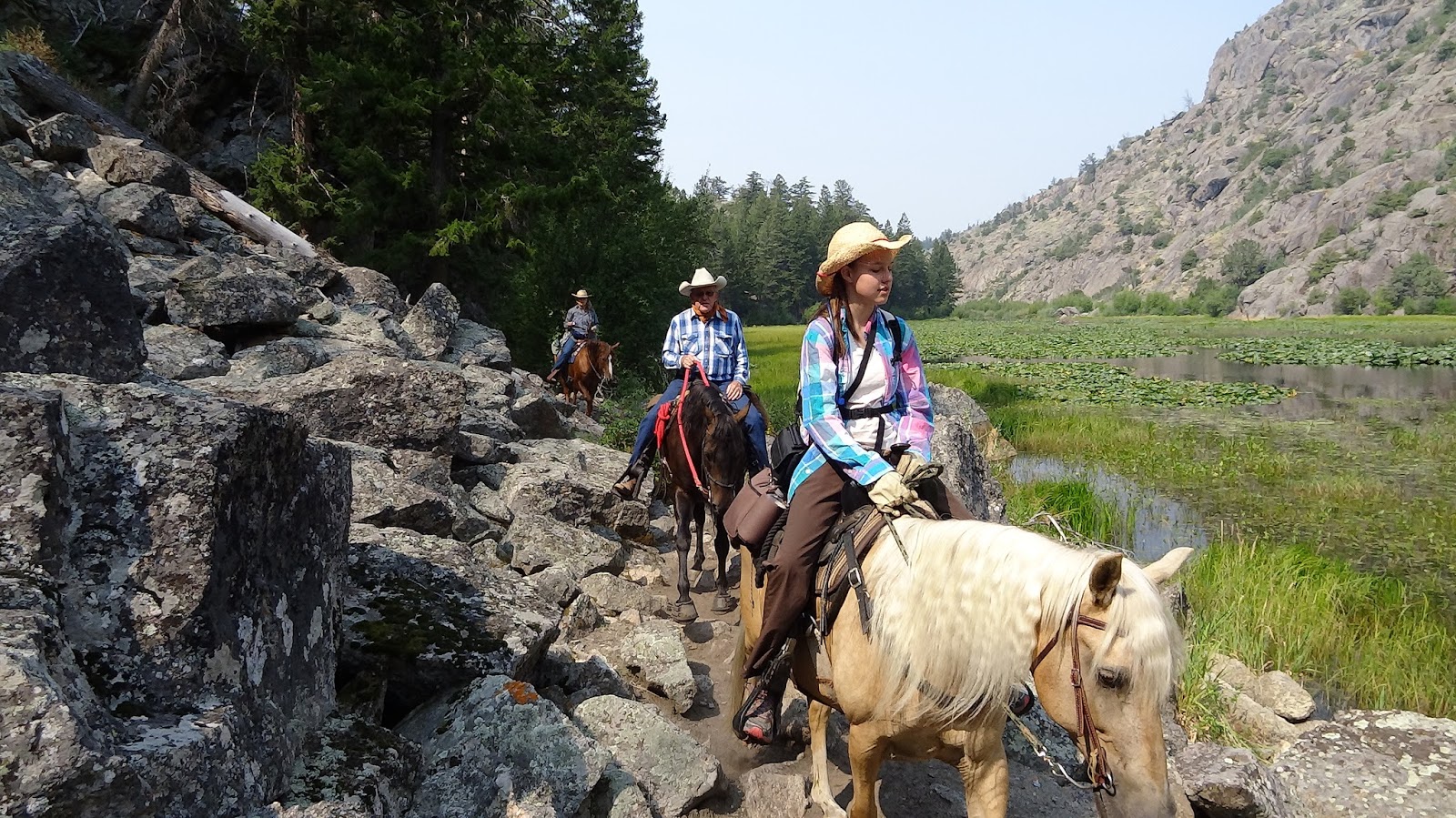
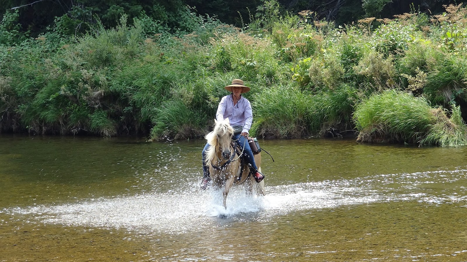
 Has most everything~~sage, bridges, stunning evergreen forest, aspens, meadows, ferns, wildflowers, epic rocks, water features including a gorgeous Lily Pad Lake. The Lily Pad Lake is about 2.7 miles in. There are places you can ride your horses in the river at about 3.3 miles in. (Except in Spring run off when it is too high and fast.) Further up the trail, there are some serious rock climbs and many sharp rocks. (Take horses at your own risk) and even more spectacular scenery and water features (waterfall). You are riding along side the river during a good part of the ride. As of 2019, some of the trail has been washed out leaving numerous rocky spots.
It is 25 miles from Pinedale, WY. Takes about 45 minutes. Google directions to "Boulder Lake Campground". Thanks to Teisha Preece for most of these photos. (Click on any photo to open an enlarged image).
Excellent video of "Wilderness Rider's" version of this ride.https://www.youtube.com/watch?v=rUBmuhz8hIw


| ||
There is a "horse corral"--livestock parking trailhead, clearly marked. When we were there June 1, 2017, it was full of puncture weed that hadn't quite matured. (As of September 1, the trailhead is just dust)There are corrals and I imagine you could camp in your trailer there. There is a rest room. There are two ways from the parking to get to the trailhead. One involves a slightly steep, rocky descent (marked with blue arrows) and the other follows the dirt road heading towards the campground (red arrows.)
|


 |
| Distance ridden, August 2015: 7 miles; Min Altitude=7,247'; Maximum altitude=7,661'; Ascent/descent=770'; trail conditions= 30% dirt/sand, 20% very rocky, 50% moderately rocky/gravelly. There are several bridge crossings and a couple of boggy areas. Barefoot horses in super good condition can do it without boots. Otherwise I recommend boots or shoes. |
 |
| Distance ridden, June, 2017; About 8 miles; Maximum altitude=7,730'; Ascent/descent=1,060'. |
 |
| Sign for the trail turn off |
 |
| First bridge crossing other than the large one for vehicles. |
 |
| Low Creek level in September, 2016 |
 |
| Creek level, May 29, 2017 |
 |
| 2nd bridge crossing, August, 2015 |

Same bridge crossing as above, going the other direction


 |
| Same bridge crossing as above...June, 2017 |
 |
| Yay..."still" water feature with bridge. |
 |
| We were pleasantly surprised by this beaver pond/lake with water lilies...spectacular! August, 2015. |
 |
| Lily Pad Lake in September, 2016. |
 |
| Loved this part of the trail |
 |
| Lily Pad "Lake" in August, 2015 |
 |
| Lily Pad Lake in June, 2017. The lake was so high, no lilies were visible. |
 |
| Lily Pad Lake, August 31, 2018 |

 |
| One of the river accesses about 3.5 miles in where we had lunch in August, 2015. In June, 2017, this was completely covered in 6-8 feet of rushing water. |
 |
| Lots of fun places for boy and dog to play in August. |
 |
| We found another water access with gravelly bottom, perfect for "playing" in the water in August. |
 |
| August, 2015 |
 |
| August, 2015 |
 |
| Same general spot as the photo above, but on June 1, 2017. |
 |
| REALLY low creek level, September, 2016 |


 |
| One of the meadows in August. On June 1, 2017, this was boggy and almost all covered in water. |
 |
| September, 2016 |
 |
| Bridge at confluence of Macs Creek. This is as far as we got on June 1, 2017. The scene below MIGHT be available if you hike/ride up a little further. |
 |
| This is a view of Boulder Creek just above the "falls" at the confluence of Macs Creek in September of 2016. The trail is really rocky at this point and the photographer hiked on foot for this shot. Photo courtesy of Teisha Preece. |
 |
| Rocks about 3.5 miles in. |
 |
| At about 3.6 miles in. |

 |
| Yep, easier to go up than down. |
 |
| This stretch wasn't too bad getting up. A little more difficult getting down. |
 |
| At about 2.7 miles in on June 1, 2017. This water is a "branch" of the creek, not there at all in previous trips. |
 |
| Near 2.7 miles, the creek covered part of the trail on June 1, 2017. |
 |
| June 1, 2017 on the way out. |
 |
| On the way out, June 1, 2017. Yes it really was this green. |
 |
| June 1, 2017 on the way out. Approaching thunderstorm. We got a few drops of rain here while Pinedale was pummeled. |
 |
| Low Creek level in September, 2016 |
 |
| The way back to the parking lot...a trail heading steeply up the hillside, then turned into this path. |
No comments:
Post a Comment