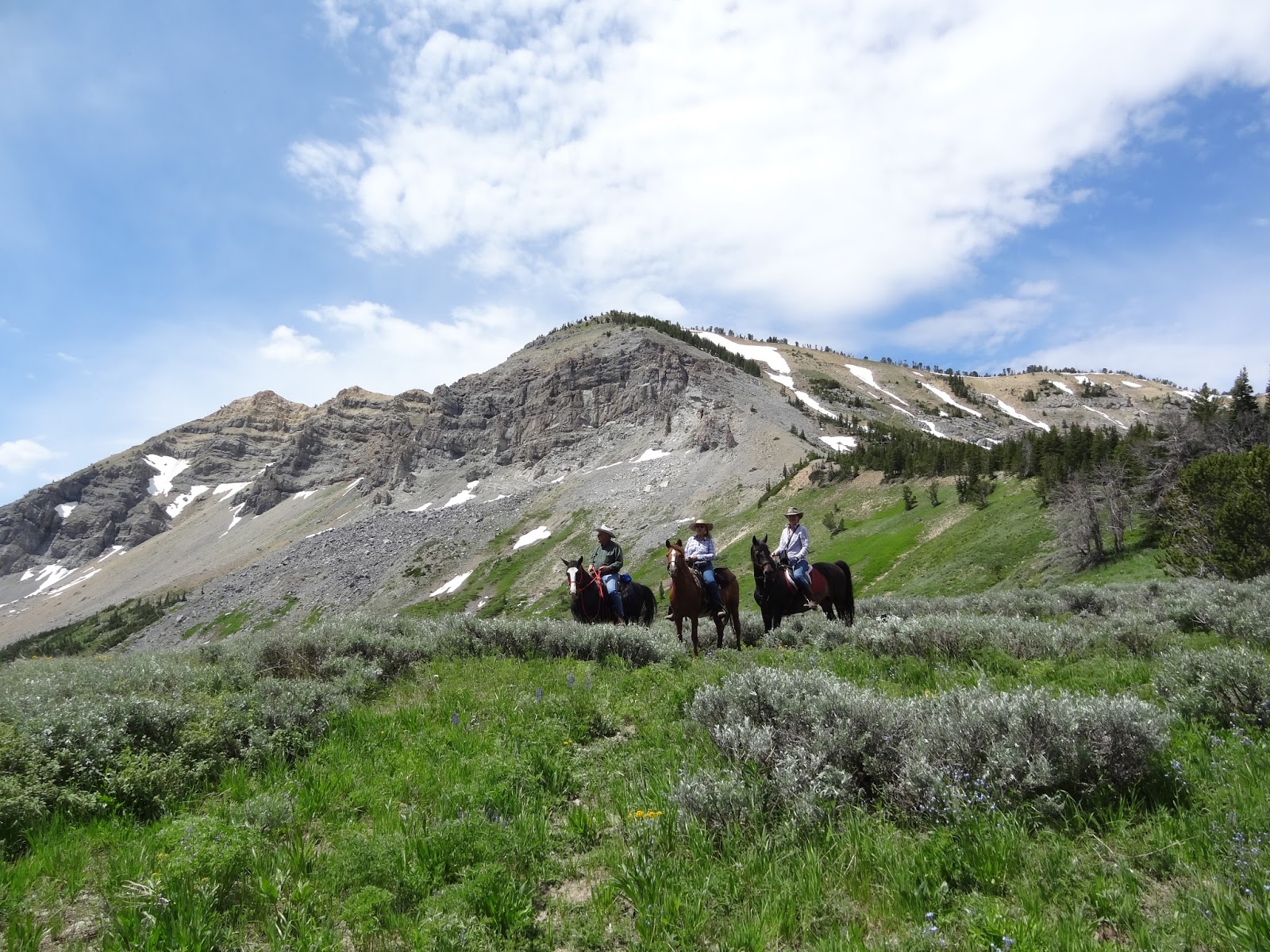
 This hidden gem is part of the National Recreation Trail. It is certainly worth doing if you are ever in the area. It is reasonably close to Jackson and Pinedale. The photo above was taken on a side spur up toward the mountain where we could see a trail winding up. That was not part of the Recreation trail, but a side path to ascend Mt. McDougal. On a future trip, we hope to ride further north on the trail. One of the impressive things was its seclusion. We only saw one other hiker. WARNING: On July 8, 2016 The deer flies were horrible! They seem to disappear after about 7 pm. I heard from locals that August is a better time to avoid them. Be prepared with plenty of repellent for you and your horses. When we rode on July 8, 2019, it was overcast and about 60 degrees with NO flies. On July 13, 2019, it was overcast and slightly breezy--Very few flies--Perfect riding weather! On August 10 we only saw a few flies in the afternoon. Please see the McDougal Gap--South post to include the Wyoming Recreation Trail (WRT) to the south of the McDougal Gap road. Both are accessible from the same parking lot. (Click on any photo to open enlarged images. Additional photography credits: Teisha and Oakley Preece)  |
| Approximately 4.5 hours from Ogden area, Utah. The turn off is just south of Daniel, Wyoming. It has a sign that says "Cottonwood-Ryegrass" You can google map for "Mt. McDougal". There are a few intersections. Keep to the left until you get to N. Cottonwood, then turn right (west). It is about 1.2 hours from Pinedale and 2.5 hours from Jackson. |
 |
| This is one way that Google Maps says to get there from Utah. NOT!!!!! This particular way is NOT recommended. Has some of the worst dirt/washboard and may not be passable with a large rig. |
 |
| This shows two ways from Hwy 189. |

 |
| Doesn't look too promising here, but we're headed towards those mountains in the distance. |
 |
| Getting closer to the forest. Once on the FS road, road conditions get worse. |
 |
| Entering Bridger National Forest. Dispersed camping is allowed here within 300 feet of any established roadway. The camping is "No trace" of course. No restroom or water at any trailhead. |
 |
| Getting closer. Lots of cattle down lower. |

 |
| This shows where the trail south may be accessed without having to ride on the road. It's marked on the road, but no sign or evidence of the trail from the larger parking area. |
 |
| Trailhead parking. The worst rocks are here. Once you're out of the parking lot, it's easy going. |
 |
| Out and back ride: 5.87 miles. Minimum altitude=8,409'; Maximum altitude=9,767'. Ascent/Descent=1380'; Trail conditions 80% soft dirt/grass, 15% somewhat rocky and 5% quite rocky or water crossing. Great for barefoot horses. |
 |
| Shady forests... |

 |
| Open meadows... |


 |
| Snow patches...This was early July in 2016. In 2019, this same spot was covered in 2 feet of snow and we didn't dare cross it by horseback. I guess it depends on how severe/snowy the winter was. |
 |
| July 8, 2016 |
 |
| Same spot as above, but on July 13, 2019 |
 |
| This shows the way we came in this spot by going below the snow field. |
 |
| Looking at the snow field from our crossing. |
 |
| This was on our way back down on July 13, 2019. We had to be careful to cross where the trail was. The snow was amazingly hard considering the warm temperature. (UPDATE: The snow is gone by July 23, 2019) |
 |
| Same place as the previous photo, looking back on July 8, 2016. |


 |
| One kind of steep part, but not bad at all. |


 |
| Incredible mountain vistas. |

 |
| Several little stream crossings. |
 |
| Wildflowers galore... |


 |
| Almost back to the parking lot. |
No comments:
Post a Comment